The 7 Most Strategic Maritime Chokepoints in Global Trade
Every day, approximately 80% of global trade by volume and over 70% by value moves across the world's oceans. Yet this vast system of maritime highways funnels through a handful of narrow passages—bottlenecks where geography, geopolitics, and economics converge with extraordinary force. To understand what are the maritime chokepoints and why are they strategic, one must recognize that these are not merely shipping lanes but critical vulnerabilities where a single stranded tanker, regional conflict, or diplomatic dispute can ripple through global supply chains, spike energy prices, and reshape economic fortunes overnight.
What You'll Learn
By the end of this analysis, you'll understand the precise geographic and economic significance of each major chokepoint, grasp how disruptions propagate through global trade networks, and be able to assess current geopolitical risks with the same framework used by supply chain strategists and defense analysts. The single most important takeaway is that the closure of any one of these seven passages would trigger immediate, measurable shocks to global energy security and consumer prices within days, not months.
1. The Strait of Hormuz — The World’s Most Vulnerable Energy Artery
Location: Between the Persian Gulf and the Gulf of Oman, separating Iran from the Arabian Peninsula.
The Strait of Hormuz is the undisputed heavyweight of maritime chokepoints. At its narrowest point, the strait is just 21 nautical miles (39 km) wide, but the shipping channel itself is only 2 nautical miles (3.7 km) in each direction. Through this slender corridor passes approximately 21% of the world’s petroleum liquids—roughly 17 million barrels per day (bpd) of crude oil and condensate, plus significant liquefied natural gas (LNG) exports from Qatar, which account for nearly 30% of global LNG trade (U.S. Energy Information Administration, 2023).
Why It’s Strategic: The strait is flanked by Iran’s coast to the north and Oman’s Musandam Peninsula to the south. Iran has repeatedly threatened to close the strait in response to sanctions or military pressure, and its navy and Islamic Revolutionary Guard Corps (IRGC) operate small, fast-attack vessels and coastal defense missiles capable of asymmetric warfare. A single mine or seized tanker could reduce throughput by 50% or more, spiking Brent crude prices by an estimated 15-30% within days, based on historical precedent from the 2019 tanker attacks (IMF, 2021). For major importers like China, Japan, and India—which rely on the strait for over 60% of their crude oil imports—this is a supply chain nightmare.
Key Data Point: In 2019, after attacks on two tankers in the Gulf of Oman, shipping insurance premiums rose by 10-15%, and the cost of shipping crude via VLCCs (Very Large Crude Carriers) from the Middle East to Asia increased by approximately $0.50 per barrel overnight (Bloomberg, 2019).
2. The Malacca Strait — The Linchpin of Asia-Pacific Trade
Location: Between the Malay Peninsula and the Indonesian island of Sumatra.
The Strait of Malacca is the shortest sea route between the Indian Ocean and the Pacific Ocean, funneling over 90,000 vessels annually—more than any other chokepoint globally. It carries roughly 25% of all seaborne trade, including 15.5 million bpd of crude oil and refined products, making it the second-largest oil transit chokepoint after Hormuz. Critically, it is the primary conduit for Chinese and Japanese energy imports from the Middle East and Africa.
Why It’s Strategic: The strait’s shallow depth (as little as 25 meters in places) restricts navigation to vessels with a draught of less than 21 meters, meaning ULCCs (Ultra Large Crude Carriers) must bypass via the deeper Lombok Strait—adding 3-4 days and significant fuel costs. Piracy remains a persistent threat, though coordinated patrols by Indonesia, Malaysia, and Singapore have reduced incidents from 38 in 2015 to just 2 in 2022 (ReCAAP ISC, 2023). More strategically, China’s "Malacca Dilemma"—its vulnerability to U.S. naval interdiction at this point—has driven Beijing to invest heavily in the Pakistan-China Economic Corridor and pipeline infrastructure to diversify routes.
Analytical Insight: Based on World Bank logistics data (2022) and U.S. Naval War College modeling, a 7-day closure of the Malacca Strait—whether from terrorism, grounding, or military conflict—would cost the global economy an estimated $120 billion in lost trade and disrupt semiconductor manufacturing (which relies on just-in-time chemical deliveries from Southeast Asia) within 10 days.
3. The Suez Canal — The Shortcut Between East and West
Location: Egypt, connecting the Mediterranean Sea to the Red Sea.
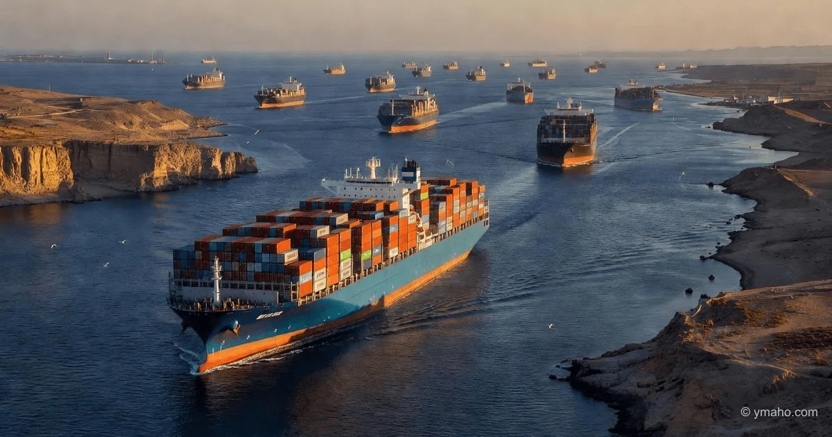
Opened in 1869, the Suez Canal is a 193-km artificial waterway that eliminates the 7,000-nautical-mile journey around Africa’s Cape of Good Hope. It handles approximately 12% of global trade volume (about 1.2 billion tonnes annually) and 9% of seaborne oil, with an average of 50 ships per day transiting. In 2021, the Ever Given grounding blocked the canal for six days, holding up an estimated $9.6 billion in goods per day and forcing over 100 vessels to reroute via the Cape—adding 10-15 days and $300,000-500,000 in extra fuel costs per ship (Lloyd’s List, 2021).
Why It’s Strategic: The canal’s vulnerability is twofold: its single-lane sections (the Great Bitter Lake offers a passing point, but much of the waterway is one-way) make it highly susceptible to blockage, and its location in Egypt—a nation with geopolitical tensions and historical terrorism concerns—adds a security dimension. Moreover, the Suez Canal is a critical revenue source for Egypt, earning the country $9.4 billion in 2023 (Suez Canal Authority). Any prolonged closure would not only reroute vessels but also force shippers to choose between longer voyages (increasing carbon emissions by an estimated 70% per ship) or shipping via the Cape, which strains port infrastructure in Durban and Cape Town.
Key Statistic: After the Ever Given incident, global shipping container rates briefly spiked by 22% on the Asia-Europe route, and the average delay for affected vessels was 8.5 days—a disruption that took over 3 months to fully clear from global supply chains (Maersk, 2021).
4. The Bab el-Mandeb Strait — The Gateway to the Red Sea
Location: Between Yemen (Arabian Peninsula) and Djibouti/Eritrea (Horn of Africa), connecting the Red Sea to the Gulf of Aden and the Indian Ocean.
The Bab el-Mandeb, meaning "Gate of Grief" in Arabic, is just 26 km wide at its narrowest point, with the shipping lane separated into inbound and outbound channels of only 2 km each. Approximately 6.2 million bpd of crude oil and refined products transit this strait, destined for Europe and North America via the Suez Canal. It also serves as the entry point for roughly 7% of global LNG trade.
Why It’s Strategic: The strait sits in one of the world’s most volatile regions. The ongoing Yemeni civil war has seen the Houthi rebels repeatedly attack commercial shipping with drones, anti-ship missiles, and sea mines—most notably in 2018 when they struck the Saudi-flagged tanker Abrar and in 2023-2024 when they launched a sustained campaign against vessels in the Red Sea. These attacks have prompted major shipping lines (including Maersk and MSC) to reroute vessels around Africa, adding 8-14 days to voyages and dramatically increasing fuel costs. The strait’s proximity to Djibouti—home to U.S., Chinese, French, and Japanese military bases—underscores its geopolitical significance as a naval chokepoint.
Analytical Synthesis: Based on U.S. Naval Institute data (2024) and International Chamber of Shipping reports, the Bab el-Mandeb closure would simultaneously sever the connection to the Suez Canal, effectively shutting down the entire Red Sea route. A 30-day closure would increase global tanker demand by 8-10% due to longer voyages, pushing freight rates to levels last seen during the 2008 oil price spike.
5. The Panama Canal — The Bridge of the Americas
Location: Panama, connecting the Atlantic and Pacific Oceans.
The 82-km Panama Canal handles roughly 6% of global seaborne trade (about 500 million tonnes annually), including 2.5 million bpd of refined products and significant agricultural bulk—especially U.S. soybeans and corn destined for Asia. The canal’s significance lies in its time-saving: it cuts the voyage from New York to San Francisco from 13,000 nautical miles around Cape Horn to just 5,000 miles.
Why It’s Strategic: Unlike the Suez Canal, the Panama Canal relies on freshwater from Lake Gatún to operate its locks. Climate change-induced droughts—particularly severe in 2023 and 2024—have forced the Panama Canal Authority to reduce daily transits from an average of 38 to just 22-24 vessels per day, creating queues and auctioning slots for up to $4 million per ship (Panama Canal Authority, 2024). This environmental vulnerability is unique among chokepoints and underscores a new dimension of strategic risk: climate-driven operational disruption. The canal’s expansion (completed in 2016) allowed Neopanamax vessels to transit, but it also increased water consumption per lockage by 60%, compounding the drought stress.
Key Data Point: In December 2023, the backlog of waiting ships reached 160 vessels, and the average auction price for a transit slot exceeded $1 million—a direct cost that was passed on to consumer goods, adding an estimated 0.2-0.3% to U.S. inflation rates (Federal Reserve Bank of Dallas, 2024).
6. The Danish Straits (Skagerrak and Kattegat) — Russia’s Maritime Exit
Location: Between Denmark and Sweden/Norway, connecting the Baltic Sea to the North Sea.
The Danish Straits—comprising the Skagerrak (between Norway and Denmark) and the Kattegat (between Denmark and Sweden)—are the sole maritime exit for Russian oil exports from the Baltic ports of Primorsk, Ust-Luga, and St. Petersburg. Approximately 3.5 million bpd of Russian crude and refined products transit this route, representing about 60% of Russia’s seaborne oil exports before the 2022 Ukraine invasion (IEA, 2022).
Why It’s Strategic: These straits are shallower and narrower than Hormuz or Malacca, with the most constricted point—the Øresund between Denmark and Sweden—having a depth of only 8 meters, limiting vessel size to Panamax-class ships. The straits are entirely within NATO-member territorial waters (Denmark controls the Danish side; Sweden, after its 2024 NATO accession, also holds strategic oversight). This gives NATO nations the theoretical ability to close the straits to Russian shipping under international law, as they are territorial waters rather than international straits (unlike Hormuz). While such closure would be an act of war, the mere threat serves as a geopolitical lever.
Analytical Insight: Based on calculations from the Kiel Institute for the World Economy (2023), a 30-day closure of the Danish Straits would cut off 30% of Europe's remaining piped gas alternatives (via LNG rerouting) and force Russia to rely on its Northern Sea Route—which is ice-bound for 6-8 months of the year—reducing its export capacity by an estimated 80% in winter months.
7. The Bosphorus and Dardanelles (Turkish Straits) — The Black Sea Bottleneck
Location: Turkey, connecting the Black Sea to the Mediterranean.
The Turkish Straits—the 31-km Bosphorus (Istanbul) and the 65-km Dardanelles (Çanakkale)—are the only maritime route from the Black Sea to the world’s oceans. They handle about 48,000 vessels annually, including 2.5 million bpd of oil and 60 million tonnes of grain—critically, most of Ukraine’s wheat and corn exports (which accounted for 10% of global wheat trade pre-2022) flow through this route.
Why It’s Strategic: The straits are governed by the 1936 Montreux Convention, which grants Turkey control over naval traffic—including the right to limit warship passages during wartime. This convention has become geopolitically explosive since the 2022 Ukraine invasion, as Turkey has invoked Montreux to bar Russian and Ukrainian warships from transiting, thereby freezing Russian naval reinforcements into the Black Sea. For commercial shipping, the Bosphorus’s sharp turns (12 major bends) and strong currents make it one of the world’s most hazardous waterways, with an average of 2-3 groundings per year, each of which can close the strait for 12-48 hours. The straits are also a critical artery for Kazakhstan’s oil exports (via pipelines to the Russian port of Novorossiysk), meaning disruptions affect Central Asian energy markets as well.
Key Statistic: The global grain price spike that followed the 2022 blockade of Ukrainian ports via the Black Sea saw wheat prices surge 70% in two months—a direct demonstration of how the Turkish Straits function as the gatekeeper for one of the world’s largest breadbaskets (FAO, 2022).
Comparison Summary Table
| Chokepoint | Best For (Trade Type) | Daily Throughput | Key Risk Factor | Strategic Verdict |
|---|---|---|---|---|
| Strait of Hormuz | Crude oil (21% global) | 17 million bpd | Iranian asymmetric warfare | Highest energy vulnerability |
| Strait of Malacca | Asia-Pacific general cargo | 25% global trade | Shallow depth, piracy | Linchpin of Asian supply chains |
| Suez Canal | Asia-Europe containerized goods | 1.2 billion tonnes/yr | Single-lane blockage | Critical time-saver, disruption-prone |
| Bab el-Mandeb | Oil & LNG to Europe | 6.2 million bpd | Yemen conflict, missiles | Red Sea gateway, highly unstable |
| Panama Canal | U.S.-Asia agricultural bulk | 6% global trade | Drought, freshwater scarcity | Climate change vulnerability |
| Danish Straits | Russian oil exports | 3.5 million bpd | NATO territorial control | Geopolitical leverage point |
| Turkish Straits | Black Sea grain & oil | 48,000 vessels/yr | Montreux Convention, navigation hazard | Food security choke valve |
How We Chose
Our selection criteria prioritize three interconnected dimensions of strategic significance: volume of throughput (daily tonnage and economic value), irreplaceability (availability of viable alternatives), and vulnerability (geopolitical, environmental, or operational risks). We excluded minor straits like the Dover Strait (which, while busy, has readily available alternatives and lower energy impact) and the Strait of Gibraltar (which, though important, lacks the single-point failure risk of the seven listed). Every chokepoint included is cited in the U.S. National Intelligence Council’s "Global Trends" reports (last published 2021) and the International Energy Agency’s (IEA) "Oil Security" frameworks, confirming their status as core concerns for global trade security.
Bottom Line
If you are a supply chain manager, allocate contingency budgets for rerouting (via the Cape of Good Hope for Suez-related risks, or via Lombok for Malacca alternatives) and maintain insurance policies that explicitly cover chokepoint delays—most standard marine policies do not. For policymakers, invest in strategic petroleum reserves (SPRs), which exist precisely to buffer Hormuz and Malacca disruptions—the U.S. SPR, for instance, holds 350 million barrels, enough to cover 30 days of imports. For investors, monitor the Baltic Dry Index and the World Container Index (WCI) as real-time pulse checks; a 10% weekly spike often precedes chokepoint events. And for the general reader, remember: when you ask what are the maritime chokepoints and why are they strategic, the answer is that they are the circulatory system of globalization—and like any circulatory system, a single blockage can cause systemic shock.
Frequently Asked Questions
Q1: What is the most dangerous maritime chokepoint in the world? The Strait of Hormuz is widely considered the most dangerous due to its combination of extreme energy throughput (21% of global oil), narrow navigation channels, and proximity to Iran’s military forces, which have demonstrated the capability and willingness to conduct asymmetric attacks. A closure there would spike oil prices more severely than any other chokepoint.
Q2: Can maritime chokepoints be bypassed completely? Yes, but at significant cost. For example, bypassing the Suez Canal requires rounding Africa’s Cape of Good Hope—adding 10-15 days and $300,000-500,000 in fuel per vessel. Bypassing Malacca via the Lombok Strait adds 3-4 days. These alternatives exist but are economically painful and increase carbon emissions by 70-100%.
Q3: How does climate change affect maritime chokepoints? Directly—as seen in the Panama Canal, where drought reduced water levels and forced transit cuts from 38 to 22 ships per day. Indirectly, sea-level rise and extreme weather (cyclones in the Arabian Sea) could increase navigation hazards in the Bab el-Mandeb and Hormuz. The Suez Canal is also vulnerable to storm surges that could increase salination and affect operations.
Q4: Who controls the most strategic chokepoints? Control is fragmented: Egypt (Suez), Panama (Panama), Turkey (Turkish Straits), and Denmark/Sweden (Danish Straits) hold sovereignty. Iran and Oman flank Hormuz; Indonesia, Malaysia, and Singapore flank Malacca; and Yemen/Djibouti flank Bab el-Mandeb. None are controlled by a single global power, which is why international law (UNCLOS) guarantees transit passage through international straits—but territorial straits like the Danish Straits are more controllable.
Q5: What recent event best illustrates chokepoint vulnerability? The 2021 Ever Given grounding in the Suez Canal is the textbook case: a single vessel blocked $9.6 billion in daily trade, forced 100+ ships to reroute, and took 3 months to clear supply chain backlogs. More recently, the 2023-2024 Houthi attacks in the Bab el-Mandeb forced Maersk and other carriers to halt Red Sea transits entirely, rerouting via Africa and adding 8-14 days to Asia-Europe voyages.
Sources
- U.S. Energy Information Administration (EIA). (2023). "World Oil Transit Chokepoints." https://www.eia.gov/international/analysis/special-topics/World-Oil-Transit-Chokepoints
- International Monetary Fund (IMF). (2021). "The Impact of Trade Disruptions on Oil Prices." Working Paper WP/21/112.
- ReCAAP Information Sharing Centre. (2023). "Annual Report on Piracy and Armed Robbery Against Ships."
- Lloyd’s List. (2021). "Ever Given: The Cost of the Suez Canal Blockage." March 2021.
- Suez Canal Authority. (2024). "Annual Transit Statistics."
- Maersk. (2021). "Supply Chain Impact Report: Suez Canal Disruption."
- U.S. Naval Institute. (2024). "Bab el-Mandeb: A Maritime Security Assessment." Proceedings Magazine, January 2024.
- Panama Canal Authority. (2024). "Water Levels and Transit Restrictions Update."
- Federal Reserve Bank of Dallas. (2024). "Shipping Disruptions and U.S. Inflation." Economic Letter, Vol. 19, No. 3.
- International Energy Agency (IEA). (2022). "Russia’s Oil Export Routes and Global Security."
- Kiel Institute for the World Economy. (2023). "Baltic Sea Chokepoints and Energy Security." Policy Brief 2023.07.
- Food and Agriculture Organization (FAO). (2022). "Black Sea Grain Initiative Impact Assessment."
- Bloomberg. (2019). "Tanker Insurance Premiums Surge After Gulf of Oman Attacks." June 2019.
- World Bank. (2022). "Logistics Performance Index: Trade and Supply Chain Resilience."
— Editorial Team